
 How to resolve AdBlock issue?
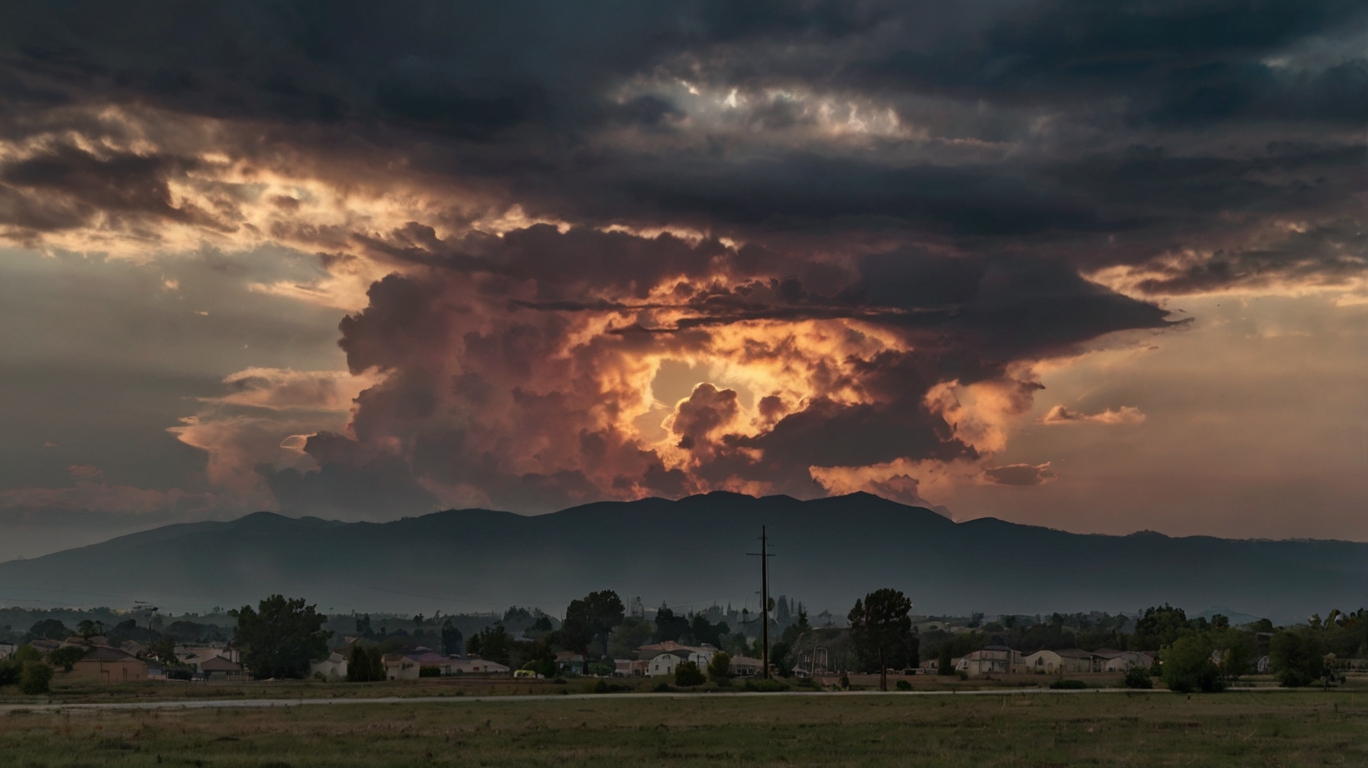
Rattlesnake Branch Fire Update Sunday
Rattlesnake Branch Fire -- Press Release U.S. Forest Service - National Forests Service in North Carolina: Rattlesnake Branch Fire Update Fire
Note: Please drive cautiously on State Route 276 and other roads around the fire.
Please do not stop along the side of the road for your protection and the protection of firefighters and equipment.
The Rattlesnake Branch Fire is on private land and the Shining Rock Wilderness Area on Pisgah National Forest around the community of Cruso, approximately 11 miles southeast of Waynesville, North Carolina. It started on March 26, 2025 and quickly spread due to dry conditions and hardwood leaves and branches on the ground. The cause is under investigation.
The fire is approximately 1,882 acres and 21 percent contained. 137 personnel are on the fire, with more firefighters and equipment on the way.
Yesterday’s Activities
The Southern Area Red Complex Incident Management Team joined in command of the fire. Firefighters took advantage of yesterday’s minimal fire behavior to continue work to protect homes and contain the fire.
Around Cruso, crews mopped up areas where they had strategically burned to reduce threats to homes. They constructed a fire containment line from Bass Pond in the Cold Creek drainage to the Shining Rock Wilderness boundary and scouted out areas, including along Burnette
Cove Road and talking to landowners to put in more firelines. They used a helicopter to ignite ridgetops, backing the fire downslope to prevent fire low in the drainage from running upslope in an uncontrolled manner and spotting over the ridgetops.
In Crawford Creek, firefighters mopped around areas that they burned on Friday to keep the fire above homes in the area and used tactical burning to improve firelines. They complete protecting structures along the bottom of the drainage and also protected powerlines.
Today’s Activities
T
oday, crews will continue to hold and improve existing fire containment lines located south of Cold Creek Road and west of Route 276. They will protect homes and mop up in Cruso and identify areas for putting in more firelines in the Burnett Creek drainage from Cold Creek to Burnette Cove Road. This will include contacting private landowners to identify opportunities. They also will identify structures to protect in this area, north of the current footprint of the fire.
Firefighters will work along the flank of the fire as it backs down from ridgetops, occasionally doing some tactical burning to even up firelines so the backing fire does not pose a risk for rapid spread. Firefighters will continue fire protection of cabins in Crawford Creek and will continue to keep the fire from burning homes as it moves up the drainage.
A UAS (drone) is assigned to the fire to help with aerial ignition, mapping and reconnaissance. The drone will fly around the Cruso area today. Other aircraft available include two large helicopters, two small helicopters, two air attack platforms and two and fixed-wing “super scoopers”.
Weather/Fire Behavior: Today’s weather will bring showers with up to a tenth inch of rain and erratic winds in the morning and a chance of thunderstorms in the afternoon. Firefighters will remain vigilant for thunderstorms and be ready to take shelter, if needed.
The high temperature is predicted to be 65 degrees, relative humidity near 60 percent, and southwest wind 7-12 mph, gusting 25 mph.
Fire potential will be moderated due to increased moisture. The fire may smolder and creep before and between rain events. Flareups are possible in thick, rain-sheltered shrub materials with high winds. Although rain is expected today and tomorrow, it is expected to be minimal; dry conditions are expected to return. Air quality information is available at Smoke Outlook for Western North Carolina and Upstate South Carolina, www.airnow.gov and www.wildlandfiresmoke.net.
Closures and Restrictions: The Pisgah National Forest has issued an area closure of the Shining Rock Wilderness Area to protect the public from wildfire and firefighting operations. This closure includes all National Forest System land between US-276 and NC-215 north of the Blue Ridge Parkway (between mile markers 405 and 420). Please stay safe and keep out of these areas.
Following the statewide burn ban issued for North Carolina, the USDA Forest Service issued a fire restriction on open-burning National Forest land, including building, maintaining or using campfires, open stove fires and fire rings, to mitigate wildfire risks.
A temporary flight restriction is in effect in and around the fire area. This includes use of personal drones. If you fly, we cannot fly!
Information 828-519-8242
Email: 2025.RattlesnakeBranch@firenet.gov
Website: https://inciweb.wildfire.gov/inc.../ncncf-rattlesnake-branch
Image: WNCTimes