

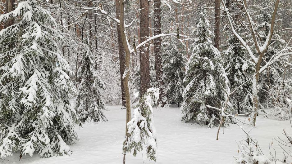
WNC Weather News: November 11, 2026: An abrupt shift to late-fall weather is sweeping across Western North Carolina, as a strong cold front brings the region’s coldest air mass of the season so far along with accumulating snow across higher elevations.
Unseasonably mild conditions will give way quickly beginning Thursday as a lead frontal system moves through the mountains, followed by a secondary surge of arctic air driven by blustery northwest winds.
What Forecasters Are Saying
Regional forecasters note that while mountain valleys will experience an intense, sudden chill, the bulk of snow will favor higher peaks and western-facing terrain:
Ray’s Weather: Forecasters at Ray’s Weather emphasize a classic northwest-flow regime. Light showers Thursday will transition over to snow showers and flurries Thursday night into Friday morning, focusing primarily along the western escarpment and the Tennessee border. A reinforcing pulse of energy Friday evening could push light snow and flurries slightly further east, tapering off early Saturday morning.
National Weather Service (NOAA / GSP): The National Weather Service in Greenville-Spartanburg notes that daytime temperatures will drop 10 to 15 degrees below early-November averages by the weekend. NWS reminds residents that with the mountain growing season officially concluded, formal Freeze Warnings are no longer routinely issued, meaning growers and homeowners must monitor temperatures directly.
Timing and Regional Impacts
Thursday: Scattered rain showers arrive ahead of the front, with afternoon temperatures in the 50s falling late in the day as colder winds set in.
Thursday Night into Friday Morning: Rain transitions to snow across higher terrain. Valleys will bottom out right around the freezing mark (30°F–32°F) by daybreak Friday, with ridge tops sinking into the 20s.
Friday: High temperatures will struggle to climb out of the low-to-mid 40s in valleys and will stay in the 30s at higher elevations. Gusty northwest winds will push wind chills down significantly.
The Weekend Deep Freeze: Broad, hard freezes settle in region-wide Friday and Saturday morning.
National Weather Service (NOAA / GSP): The National Weather Service in Greenville-Spartanburg notes that daytime temperatures will drop 10 to 15 degrees below early-November averages by the weekend. NWS reminds residents that with the mountain growing season officially concluded, formal Freeze Warnings are no longer routinely issued, meaning growers and homeowners must monitor temperatures directly.
Timing and Regional Impacts
Thursday: Scattered rain showers arrive ahead of the front, with afternoon temperatures in the 50s falling late in the day as colder winds set in.Thursday Night into Friday Morning: Rain transitions to snow across higher terrain. Valleys will bottom out right around the freezing mark (30°F–32°F) by daybreak Friday, with ridge tops sinking into the 20s.
Friday: High temperatures will struggle to climb out of the low-to-mid 40s in valleys and will stay in the 30s at higher elevations. Gusty northwest winds will push wind chills down significantly.
The Weekend Deep Freeze: Broad, hard freezes settle in region-wide Friday and Saturday nights, with valley lows plunging into the mid-20s and sheltered mountain hollows dipping into the lower 20s.
Snow Accumulations: Where to Expect It
Higher Peaks & NC/TN Border (Above 3,500–4,000 ft): Accumulations of 1 to 3 inches are expected on wind-favored slopes and high ridges, with isolated higher totals possible across the Smokies and northern mountain peaks.
Valleys & Foothills (Asheville, Waynesville, French Broad Valley): Rain transitions to scattered flurries late Thursday night into Friday. Little to no accumulation is expected on road surfaces, though a quick dusting cannot be ruled out on grassy or elevated surfaces.
Preparing for the Freeze
Plumbing: Disconnect garden hoses and wrap exposed outdoor spigots before Thursday evening.
Sensitive Plants: Bring potted plants indoors or ensure sensitive fall landscaping is thoroughly protected.
Pets & Livestock: Make sure outdoor animals have dry, insulated shelter blocked from northwest winds, and check water troughs frequently to prevent freeze-over.
Travel: Be mindful of isolated slick spots or black ice across high-elevation passes late Thursday night and early Friday morning.