

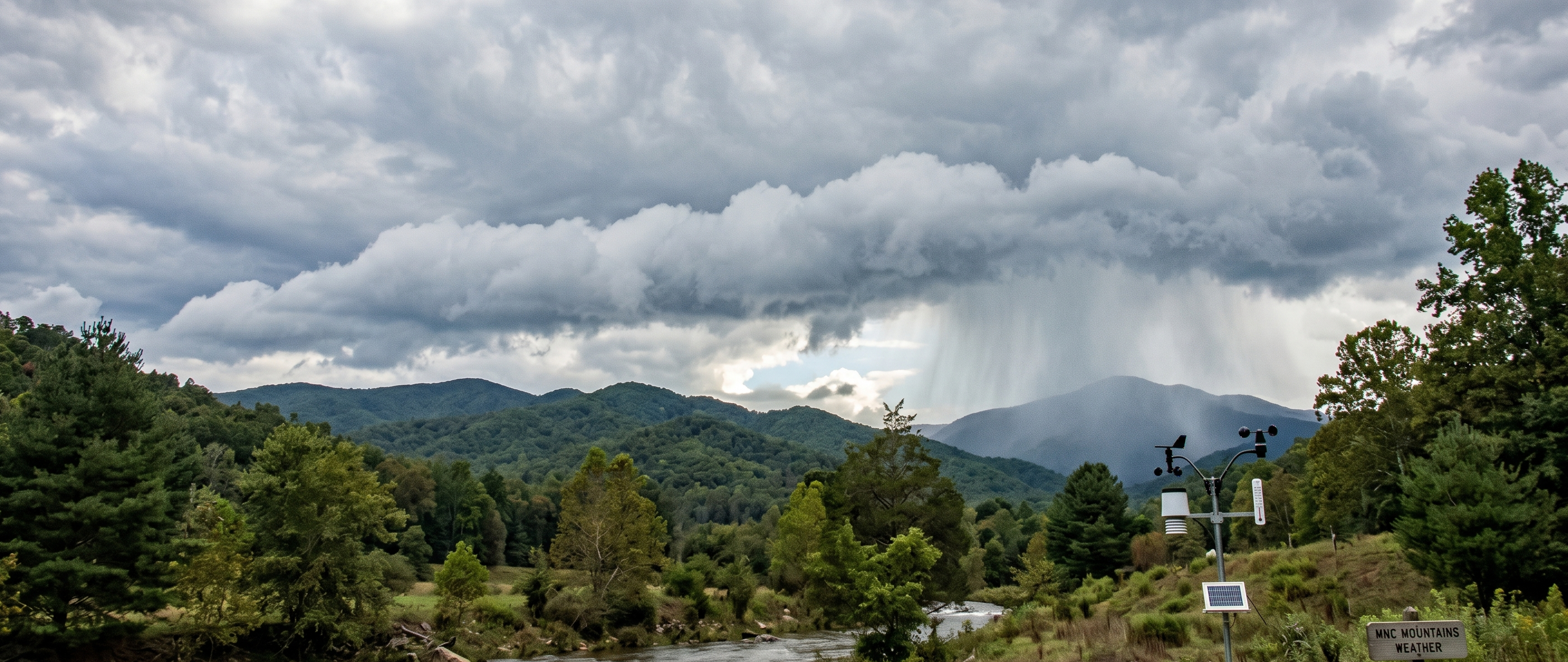
WNC Hurricane Season -- June 1, 2026: The calendar has officially turned to June, marking the formal start of the 2026 Atlantic hurricane season. For Western North Carolina, this begins a critical six-month window stretching through November 30, with the most volatile and dangerous peak arriving between mid-August and late October.
Recent regional broadcasts —have carried a headline that sounds reassuring on the surface: formal outlooks are projecting a "below-normal" season. However, for a mountain region still actively healing from severe infrastructural damage and unstable hillsides, weather experts and emergency managers warn that "below-average" numbers do not mean we can let our guard down.
Complicating this year's readiness is a quiet, profound transformation occurring behind the scenes at the National Oceanic and Atmospheric Administration (NOAA)—the parent agency of the National Weather Service. A fierce, months-long political battle over funding and personnel has left the nation's premier weather agency operating under a fundamentally altered framework, creating immediate shortages today and serious structural risks for tomorrow.
Part 1: The 2026 Forecast & The Unique Threat to WNC
According to the official seasonal outlook released by NOAA’s Climate Prediction Center, forecasters are predicting a 55% chance of a below-normal season. The agency estimates a total of 8 to 14 named storms, 3 to 6 hurricanes, and 1 to 3 major hurricanes (Category 3 or higher). Colorado State University’s (CSU) highly regarded tropical forecasting team issued a similar outlook, projecting 13 named storms and 6 hurricanes.
The Engine Behind the Calm: El Niño
The primary driver behind this quieter projection is a robust El Niño weather pattern in the Pacific Ocean. For the Atlantic basin, El Niño acts as a massive atmospheric spoiler. It generates powerful vertical wind shear—strong, high-altitude winds that literally tear developing tropical systems apart in the upper atmosphere before they can organize into dangerous, tightly coiled hurricanes.
Why "Below-Normal" is Deceptive in the High Country
While coastal states might view a quiet forecast as a relief, Western North Carolina operates under a completely different set of physical laws. It only takes a single storm to cause a disaster.
When an active tropical system moves inland and hits the Appalachian Mountains, it triggers a phenomenon known as orographic lift. The steep terrain forces the warm, moisture-laden tropical air mass rapidly upward into the cooler atmosphere. This causes an immediate, catastrophic "sponge-squeezing" effect, dropping immense amounts of rain over our river basins in a matter of hours—regardless of whether the storm has weakened to a tropical depression or a remnant low.
Because our mountain slopes, private roads, and public culverts are still highly vulnerable from past severe weather events, our regional threshold for flash flooding, washouts, and mudslides is lower than it has been in decades.
Part 2: The Battle of the Budget—What Happened to NOAA?
Earlier this year, rumors circulated heavily across social media and regional commentary that NOAA had been completely defunded. While that did not occur, the agency came exceptionally close to a historic financial gutting.
When the administration rolled out its initial fiscal year 2026 budget proposal, it targeted NOAA with a sweeping $1.7 billion slash—representing a 27% reduction in the agency's total funding.
The explicit intent of the proposal was to dismantle the Office of Oceanic and Atmospheric Research (OAR), NOAA’s fundamental scientific research arm. The administration’s plan outlined the complete elimination of federal grants to university climate scientists, the shutdown of coastal and deep-sea monitoring networks, and the termination of long-term climate modeling laboratories.
Part 3: The Bipartisan Resupply—Congress Intervenes
Under the United States Constitution, the executive branch can only propose a budget; only Congress holds the power of the purse. When the administration’s proposal landed on Capitol Hill, it faced immediate, aggressive pushback from a bipartisan coalition of lawmakers.
Representatives from coastal states, agricultural belts, and flood-prone inland regions publicly warned that stripping NOAA’s capabilities would leave the American public blind to natural disasters.
In January 2026, a bipartisan spending bill was signed into law that soundly rejected the administration's severe cuts.
The Funding Total: Congress authorized $6.17 billion for NOAA, flatlining the budget to keep it stable with the previous year's operational baseline.
The Public Safety Safeguard: Crucially, Congress directed a specific funding increase to the National Weather Service (NWS). This explicit firewall ensured that local forecast offices, radar maintenance, emergency alert systems, and satellite operations remained fully funded.
Because of this bipartisan rescue, the short-term tools we rely on this summer are completely intact. The NEXRAD radars covering WNC are spinning, weather satellites are broadcasting real-time data every 30 seconds, and the NWS just launched an upgraded, AI-driven National Blend of Models (Version 5.0) to improve short-term wind and rain accuracy.
Part 4: The National Toll—Staff Shortages and Structural Changes
Though Congress protected NOAA's financial bottom line, the administration used its executive authority to fundamentally reshape the agency from the inside out. By implementing aggressive hiring freezes, refusing to renew independent research contracts, and offering targeted buyouts, the administration has successfully hollowed out the agency's workforce. NOAA is entering this June operating with roughly 1,800 fewer employees than it had at the start of 2025.
While Congress legally protected frontline meteorologists at local forecasting desks, the loss of support staff has sent shockwaves across the entire country:
Critical Vacancy Rates: Internal data reveals that nearly half of the 122 regional NWS forecast offices are currently experiencing vacancy rates of 20% or higher. Multiple stations across the northern and central U.S. have been forced to curtail daily weather balloon launches, directly reducing the real-time atmospheric data fed into our national supercomputer models.
The Emergency Hiring Scramble: Recognizing the public safety risk as severe spring weather collided with the start of hurricane season, the NWS launched an emergency initiative to fast-track the hiring of several hundred entry-level meteorologists. However, career experts warn this won't fix the immediate season, as fully training a new hire on complex localized radar systems takes months.
The Pivot to "Triage" Staffing: To manage the labor shortage, the agency is quietly implementing a tiered staffing philosophy. Resources are actively being shifted away from quieter, rural, or inland areas to temporarily "beef up" major metropolitan hubs and highly populated coastal zones, increasing the risk that severe, localized weather anomalies in smaller communities could face delayed warnings.
The Long-Term Verdict: Surviving on Borrowed Time
For the immediate future, the system works. If a tropical storm hits the Southeast this August or September, the tracking numbers, flash flood warnings, and radar data you see on your phone or TV will be entirely reliable. The career meteorologists are at their desks, and the satellites are flying.
The true cost of the administration's policies will not be felt this June. It will be felt 5 to 10 years down the road, when the global climate continues to shift and we realize we stopped doing the foundational research required to build the next generation of predictive weather models. The federal government has already halted NOAA’s long-standing public tracking of "billion-dollar climate disasters"—a critical historical database that has now been handed over to the non-profit organization Climate Central to maintain.
Until then, regional preparation remains a hyper-local responsibility. As we step into the active months of this season, mountain residents are urged to monitor real-time local tools like the state’s Flood Inundation Mapping and Alert Network (fiman.nc.gov) and DriveNC.gov rather than relying on national headlines.
For continuing coverage of local infrastructure readiness and daily emergency management updates across counties, follow official municipal reporting portals and independent regional updates.